SUMMER SCHOOL OF ALBANIAN ALPS III
Mapping the Cultural Landscape in the Settlements of the Albanian Alps
July 3rd to 9th, 2026
“Albanian Alps” National Park
Kelmend, Albania
An event organized by GO2, as part of the Tramontana Network project.
It is a great blessing for researchers, but also for occasional visitors, that the villages of the Albanian Alps—although they are among the oldest settlements—continue to survive into the new millennium. Most of their people have left while still looking back: towards the graves of their ancestors and the dreams of childhood—dreams that sometimes fade and sometimes shift their ground, because both are bound together by one irreplaceable element: the land.
In the mountains, land is insufficient for life and, at times, even for graves. Its scarcity in the mountains of Kelmend may be confirmed as one of the principal reasons for the departure of people over the centuries.
Three of the four villages that, according to legend, founded Kelmend—Selca, Vukli and Nikçi—developed by expanding into new settlements because there was not enough land. Selcë expanded into Gropat e Selcës and Vermosh, Vukël into Lëpushë, and Nikç into Brojë and Budaç. Archaeological observations carried out over the past two or three years suggest that traces of older settlements should be sought from Pshtan to Grabom, Kozhnje and elsewhere: on terraces damaged by erosion, in caves and rock shelters along the Cem, and on the steep mountainsides. Because they remain undocumented, these settlements are now at risk of disappearing even from oral accounts—the only record that still sustains the legendary pride of Kelmend, which its people carried with them wherever they went: whether they descended southwards towards Nënshkodër and the banks of the Mat, or moved farther north towards Kosovo and as far as the borders of Hungary.
There are many reasons why the centuries of the Middle Ages erased the traces of the earliest settlements, and no one can blame the people of Kelmend for this. Yet everyone could blame Albanian researchers if they allowed modern times to cover over the mountain settlements of today.
For this reason, GO2Albania began several years ago a process of documenting these settlements in detail through multidisciplinary research programmes. In the new millennium, the first settlement documentation projects were undertaken in the Shala and Valbona valleys, and more recently in Kelmend. Nevertheless, the first detailed documentation of an entire settlement was carried out in Nikç last year through the Second Albanian Alps Summer School.
Because Nikç is very small and lies within rugged, rocky terrain, it has been unable to expand within its own boundaries. Some families therefore gradually moved away and established a new settlement: Broja. Later, they established another new settlement: Budaç. Nikç now extends across three settlements which, symbolically, may be said to represent three generations: “mother”, “daughter” and “granddaughter”.
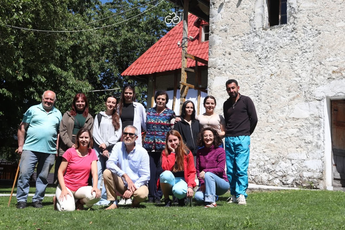
For this reason, the Summer School of Albanian Alps III aimed to document Budaç, the youngest settlement created from Nikç. The School was held from Friday, July 3rd, to Thursday, July 9th 2026, with the participation of students of architecture and urban planning from several universities in Albania and Kosovo, together with experts from different fields.
Summer School III moves farther north:
Divided between two locations—Budaç as the fieldwork camp and Lëpushë as the base camp and laboratory—the School opened with a series of lectures held on the first day. The invited speakers on the “Albanian Alps” National Park were Mr. Agim Dardha, Director of the Regional Administration of Protected Areas Shkodër (RAPA), and Mr. Tonin Macaj, Head of the Management Sector at the RAPA Shkodër. The lecture on cultural landscape was delivered by Ms. Eltjana Shkreli, a PhD candidate at the University of Genoa in Italy, while the architect Liridona Ura provided participants with detailed guidance on the practices used to document the cultural landscape of a settlement.
Following the methodology developed by GO2Albania for each working process and documentation practice, the participants were divided into two groups during the fieldwork. The study area covered approximately 40 ha on both sides of the Budaç stream, where the settlement of the same name was established from the middle of the last century onwards. In two or three sections, the stream valley forms a relatively level plain, created by erosion, material deposited by the stream and of course, human labour. The work of local people also created the steep terraces on the mountain slopes. These were once cultivated mainly with potatoes, but now serve only as grazing land for the small flocks belonging to the few houses that remain inhabited throughout the year.
As in Nikç one year earlier, the documentation of the cultural landscape of Budaç included all built structures, regardless of their function—whether residential or service-related—as well as additional elements such as fences, dry-stone walls, cultivated land, agricultural crops, plants and trees.
Budaç is one of the most beautiful settlements in Kelmend, with an exceptionally rich cultural landscape whose layers date back to the beginning of the last century and become increasingly visible over the past 60-70 years. Because people moved here in search of land, its parcels dominate the landscape of Budaç. They were therefore documented together with the agricultural practices applied by local people over the course of the last century.
The documentation identified approximately 100 structures and hundreds of cultural landscape elements, including bridges, bunkers, huts, fountains, haystacks and others, as well as a much larger number of fences made using a range of traditional and modern materials and techniques. The field documentation process itself includes observation, photography, measurement, drawing, mapping and, most importantly, conversations with local residents.
Despite the present historical moment, shaped by a lack of information regarding the possible consequences of implementing the most recent laws adopted by the Government—a situation that naturally creates uncertainty and mistrust—most residents of Budaç welcomed the Summer School groups during their fieldwork. They provided important information about when their ancestors first settled there, the course of the settlement’s development and the practices of everyday life.
Deda, Lushi, Filja, Doda, Petriti, Zefi, Rroku and others shared with the Summer School participants the stories of their own lives and those of their families—lives that have often not been easy to live and are, as such, even more difficult to recount. Collected and documented using digital equipment and field notebooks, these accounts were processed each afternoon during the second part of the day, in what became known as the Summer School laboratory.
The data entered into the various formats of specialised documentation programmes will continue to be organised over a long period into separate files and sub-files. They will be added to the archive and the database based on Geographic Information System (GIS) already established by GO2Albania for the three largest valleys of the Albanian Alps: Valbona, Shala and Cem.
The Kelmend tribe living in the Cem Valley has so far received the most detailed documentation of material and intangible cultural heritage undertaken by GO2Albania. This documentation is a process that cannot be brought to a close at any single moment in time.
It has therefore continued for at least 5 years and encompasses not only the built and natural environments, but also a rich body of oral histories, semi-structured interviews and demographic data from different periods of the 20th century, supported by a broad series of first-person accounts concerning the origins of dozens of families in the area. Preserved in both digital and physical formats, this entire body of documentation will enable future generations to understand Kelmend in depth—its origins and the different stages of its historical development.
By stimulating rapid development through policies designed in Tirana’s concrete, air-conditioned offices—the measures adopted in recent years may further diminish this cultural landscape by erasing the traces of the ancestors. Anyone who has learnt to read old maps immediately understands how many graves and burial grounds, wells, fountains and other places of collective memory have been built over by houses, roads, apartment blocks and entire neighbourhoods in towns and villages—and this undoes history.
Yet, however modest they may appear, such landscapes were created over centuries through the sustainable interaction of highland people with their environment. They never took from natural resources more than they needed for a simple life. This interaction consists of dozens of everyday practices relating to the land, forest, water, pastures, livestock, house, sky, snow, rain and wind, but also to the creations of the rich human imagination: the mountain fairies, the guardian spirits, the serpent, the shadow…
Therefore, beyond its idyllic appearance, the landscape carries within it the spirit of the people who created it.
The participants’ experiences:
Summer Schools and Summer Camps provide young professionals with an excellent opportunity to learn informally about those practical dimensions which, fortunately, the education system has not been able to rigidly formalise and incorporate into academic curricula. For this reason, participants—students and young professionals alike—apply in large numbers to such calls.
As several of them wrote after this Summer School, they come specifically to gain professional experience, but also to expose themselves to new places and realities, including different ways of life. Yet their encounters with nature, people and fieldwork are so powerful that they may experience “a cultural shock”.
“The way people speak, the way they live and perceive life, the hardships and the discovery of peace through sacrifice, the courtesy and all this natural beauty—I found them precisely here,” writes Anisa, one of the participants in the third edition of the Summer School.
Velisa writes that she encountered “…at least seven new and inspiring characters, without even mentioning the kindness and hospitality of the family with whom I stayed, and of all the villagers who enabled us to gain a glimpse into their daily lives. The study area, Budaç, must be a blessed place; it is fortunate that it remains inhabited.”
For Flaviana, the experience “included professional improvement, but also social integration and the magnificent nature of the Alps”, while Viola writes that “the immense work you have undertaken ensures that this way of life will remain tangible and understandable for future generations”.
As with many other participants, GO2Albania gave Shkurte the opportunity to see, experience and learn in real life “everything she had learnt at university” about cultural heritage.
GO2Albania’s commitment to heritage documentation
This was the third Summer School of Albanian Alps organised by GO2Albania. The first Summer School of Albanian Alps was held in Lëpushë, Kelmend, on July 23rd – 28th, 2023. The second Summer School Albanian Alps was held from 11th to 21st of July 2025 and aimed to map the cultural landscape of an Alpine settlement—the village of Nikç in Kelmend, one of the best-preserved settlements in the region. To date, these are the three editions of the Albanian Alps Summer School organised by GO2Albania.
Since 2017, however, GO2 has organised several summer schools in the Albanian Alps in partnership with various international and regional agencies and organisations.
In May 2017, GIZ and the National Agency of Protected Areas, in cooperation with the University of Kassel in Germany, GO2Albania and the Polytechnic University of Tirana, organised a Summer School in Theth to introduce participants to the village’s built heritage. One year later, on 2 November 2018, GO2Albania equipped the Theth Visitor Centre with extensive information on the area’s natural and cultural heritage and completed its interior furnishing.
In 2021, Cultural Heritage without Borders Kosovo, in cooperation with GO2, organised a summer school in the Valbona Valley to inventory its traditional tower houses. One year later, in 2022, Cultural Heritage without Borders Albania and GO2 organised the 49th Regional Restoration Camp in Lëpushë, Kelmend, for the digital documentation of local architecture. In 2024, the Goethe-Institut Tirana, in cooperation with GO2, organised an environmental camp in Lëpushë, Kelmend, to introduce participants to elements of the cultural and natural landscapes of the Alps.
Budaç of Nikç:
Budaç is one of Kelmend’s newer settlements. Until the beginning of the 20th century, its pastures were used during the summer for the herds of goats and flocks of sheep belonging to families from Nikç and Brojë. Only families from these two villages held shares in this mountain pasture, because each of Kelmend’s older settlements had, and in some cases still has, its own high-mountain pastures. Lëpushë was therefore settled by families who came from Vukël, while Vermosh was settled by families originating from the village of Selcë.
In his notes, Franz Nopcsa described Budaç in the autumn of 1907 as one of the safest, most civilised and cleanest mountain settlements of the period in the Albanian Alps. A little more than a decade later, the first families decided to remain in Budaç even during the harsh winters, while its first two proper houses date from the period of the Second World War. Consequently, in 1947, only two houses and a total of eleven inhabitants were recorded in Budaç.
Older residents recall that until the 1960s there was only one traditional two-storey kullë, with stone walls and a roof covered with pine boards. The remaining dwellings had been constructed in the style of seasonal shepherds’ huts, often supported against or partly embedded into the mountainside: small, low, single-storey houses with timber front façades, dry-stone walls on the other three sides, small windows and roofs covered with pine timber.
At present, only two or three such buildings have survived from that period. They are distinguished by the proportions of their building footprint, with ratios ranging from 1:4 to 1:3. Most of the other construction and territorial interventions that shaped the physical character of the present settlement were carried out between 1960 and 1990, while the changes made during the most recent decades have been more limited.
In 1970, two years after the opening of the vehicle road, Budaç became the centre of a forestry exploitation sector because of its centuries-old fir and beech forests. This led to the extensive felling of old woodland, but at the same time it increased the living standards of local residents. Almost every family had one member employed by the state enterprise, where wages were several times higher than those earned by the remainder of the population—the farmers and livestock breeders working in the agricultural cooperative.
At the height of its development during this period, Budaç had approximately fifteen houses, a primary school, a mill, a water-powered sawmill, a dairy for processing milk, several stables and other facilities.
Following the transformation of Albania’s political system, the village began to be abandoned. During the past decade, however, several families have attempted to become involved in tourism alongside livestock farming and agriculture. Although twenty houses are counted today, some have been abandoned or are occupied only during the summer, because the number of people living there throughout the year is smaller than the number of houses.
All the inhabitants of Budaç belong to three brotherhoods, despite bearing different surnames: Hasaj (Dukaj), Turkaj and Naçaj (Neçaj, Nekaj).
The settlement extends along both sides of the Lëpushë stream, which forms part of the Vermosh River—the only river in Albania said to flow “backwards”, from west to east, and the river that brings Albania into the drainage basin of the great Danube.
Within the inhabited area, the bed of the Lëpushë stream begins at an elevation of 1,255 m above sea level and descends by approximately 50 m towards its lower end, while the houses rise to an elevation of 1,360 m. The Haramia stream and Shutica e Grebenit are the two largest streams descending on the left-hand side of Budaç. On the right are two branches of the Trojan stream, followed by the Kacelaj stream, the Caca stream and others.
Running from south to north, the Budaç valley is approximately 5.5 km long, although the settlement is concentrated within its first two kilometres. In this inhabited section, the valley floor is between 100 m and 300 m wide. Farther north, in the gorge below the cliffs of Perluga, it narrows to only twenty-five metres.
The settlement has seven small bridges leading to the residents’ private roads, as well as two larger concrete bridges on the motor road which passes through Budaç and connects Qafë Predelec with Vermosh.
Administratively, Budaç is one of the 3 neighbourhoods of the village of Lëpushë, alongside Gropat e Selcës and Lëpushë itself.
Endnote:
© 2026 GO2Albania. All rights reserved. This material, including text and photographs, may not be reproduced, published, adapted or distributed, in part or in whole, without the prior consent of GO2Albania.
The Summer School of Albanian Alps III was organized in cooperation with the Administration of Protected Areas Shkoder, the Tramontana Network and with the financial support of the Prespa Ohrid Nature Trust (PONT) and the European Union through the Creative Europe programme. The content and opinions expressed in this article are the responsibility of the authors and do not necessarily represent the position of the donors.


